-
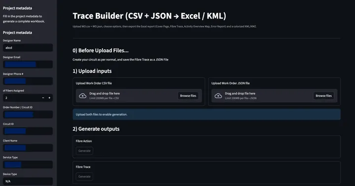
SmartTrace: Streamlit Embedded Tool for Automating Fibre Trace Reports from Work Orders & Circuit Data
-
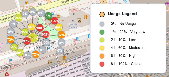
Building a Scalable Fiber Capacity Dashboard: From Static Reports to Real-Time Spatial Intelligence
-
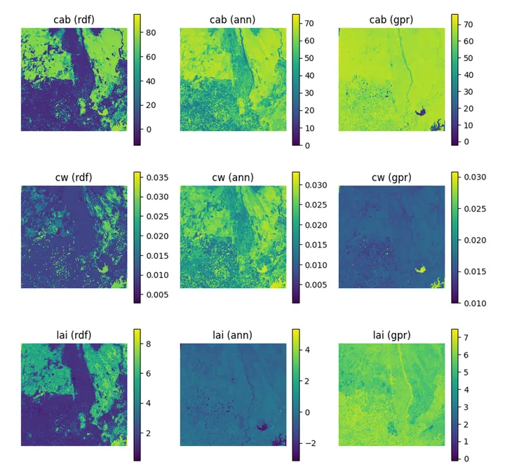
Unlocking the Potential of PRISMA Hyperspectral Imagery for Precision Agriculture Mapping
-
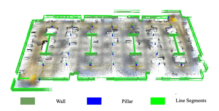
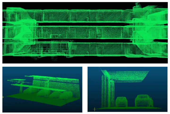
MSc Thesis: Semantic Modelling of an Indoor Parking Garage Using Hand-held GeoSLAM LiDAR Point Clouds
-
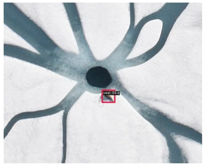
Enhancing Seal Detection in Arctic Regions through Fine-Tuning of FasterRCNN: A Case Study Using NOAA & DFO Datasets
-
Semantic Segmentation using Deep Neural Networks in a GNSS-denied Underground Parking Lot
-
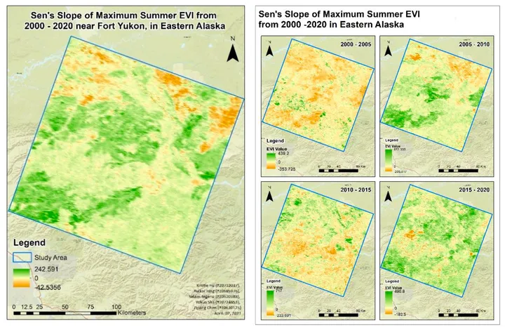
Indirect Detection of Permafrost Degradation in Eastern Alaska Using Modis and Landsat Data
-
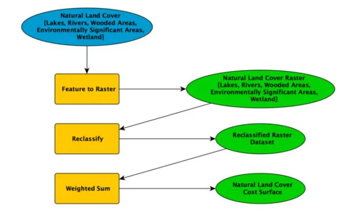
Using Least Cost Path Analysis to Plan a New Bypass Route on Highway 401 to Mitigate Traffic Congestion and Impacts in the City of Toronto
-
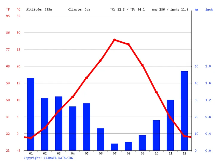
Multiple Linear Regression Model for Ontario Temperature
-
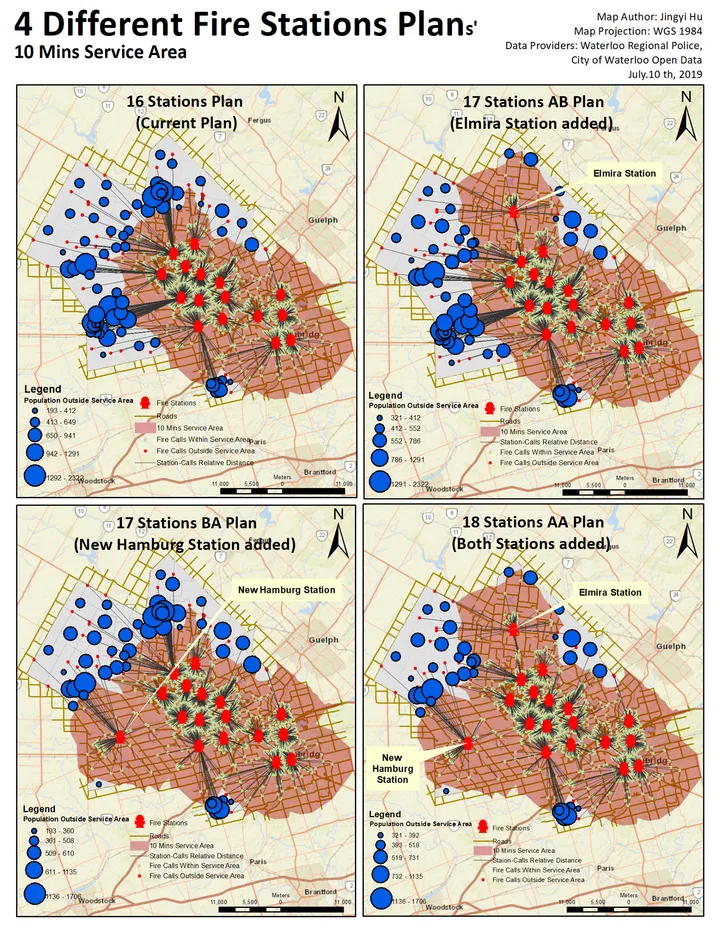
Optimizing Fire Station Coverage in Waterloo, Ontario Using Network-Based Response-Time Analysis
-
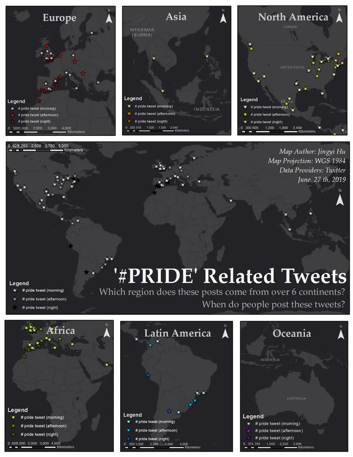
Mapping Global #Pride Discourse: A Geospatial Analysis of Twitter Data