Optimizing Fire Station Coverage in Waterloo, Ontario Using Network-Based Response-Time Analysis
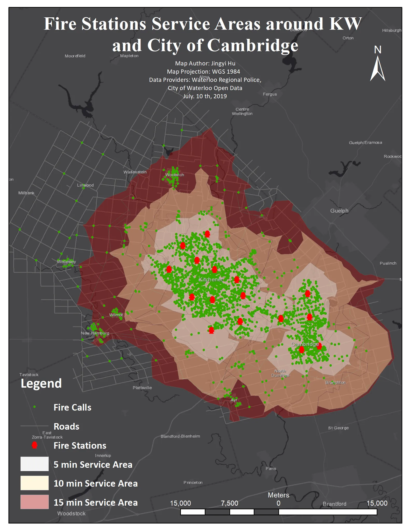
The map above presents the current service coverage of Waterloo fire stations across 5-, 10-, and 15-minute response thresholds. Service areas are generated through network-based travel-time modeling, using observed fire-call data to ensure results reflect real operational conditions rather than Euclidean distance assumptions.
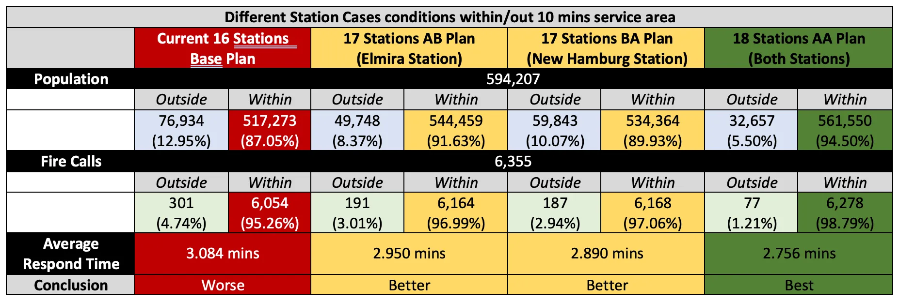
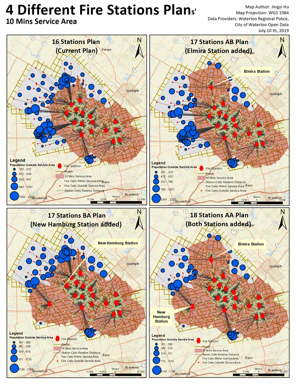
The grouped maps below benchmark the existing station configuration against three proposed deployment scenarios. Each alternative is quantitatively evaluated by its ability to maximize 10-minute response coverage, enabling a data-driven comparison of operational efficiency and emergency responsiveness across the Waterloo region.